All apps
Emergency · DK

BlåBlink

See what the siren is about — fires, crashes and police reports across Denmark.

What it does

BlåBlink gathers Denmark's emergency call-outs, road accidents, police reports, power cuts and weather warnings in one place, as a list and on a map. You pick a radius, so you only see what is happening around you. Free, no ads, and your location is never shared with us.

  • Fire and rescue call-outs across the country
  • Crashes and closed roads from the road authority
  • Police reports, power cuts and DMI weather warnings
  • Denmark's five air ambulance helicopters, live in the air
  • Notifications by severity, source and time of day
  • Emergency number and out-of-hours doctor one tap away

BlåBlink is an unofficial app with no ties to the police, the fire and rescue services or the Danish road authority. The app updates in the background, so notifications can arrive late. Where the source only knows the area, the map shows an estimated area instead of an address. If a life is in danger, always call the emergency number.

How it works

Why are they driving past with blue lights?

Fire service call-outs, police reports, closed roads, power cuts, weather warnings and the air ambulance are all public — but spread across six different feeds, none of them built to read on a phone. BlåBlink gathers them in one place, sorted by how close they are to you.

01

What is happening now, nearest first

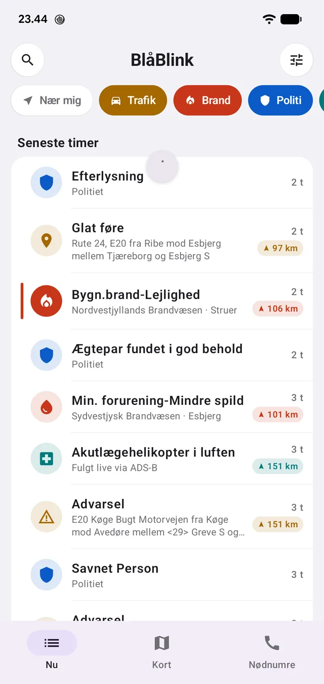
The front page is a timeline: what has happened over the last few hours, with category, place and how far away it is from you. A fire in Struer 106 km away carries its distance, so you can see at once whether it is your own town or news from the other end of the country.

The chips at the top switch the categories on and off — traffic, fire, police, helicopter, power, weather — and 'near me' cuts away everything outside your radius.

The list is a list, not a news feed. Police reports appear as headline and time with a link to the police's own page; the body text is fetched only when you open the item, and never stored.

  • Sorted by time, with a distance on every event
  • Categories can be switched off individually
  • A radius around your position that you set yourself
  • Routine tasks from the fire services are hidden by default
Fire, police, traffic and helicopter in one list, each with its distance from you.
02

The whole country on one map

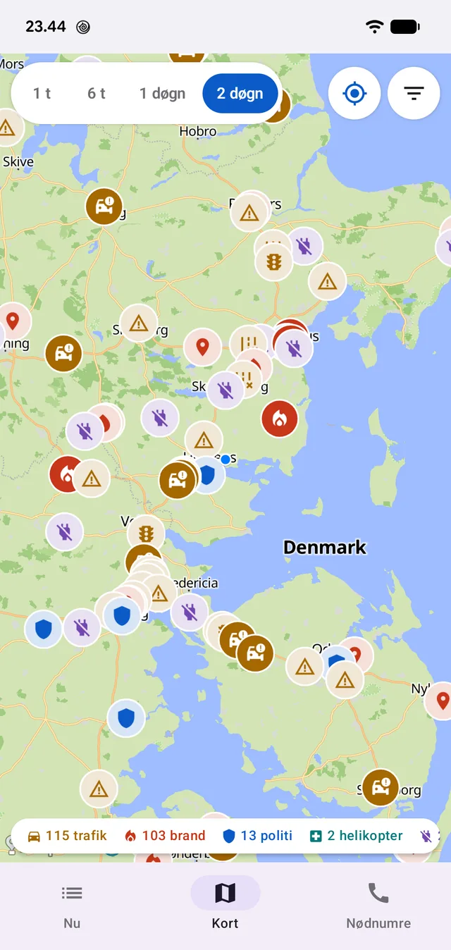
The map shows every event at once and lets you step back in time: the last hour, six hours, a day or two. The counter at the bottom says how many there are of each kind in the chosen window — here 115 traffic events, 103 fire and rescue call-outs, 13 police reports and two helicopters in the air.

The map is locked to Denmark, because the sources are Danish. Press the location button and it jumps to your own position rather than guessing.

Two days of events at once, with a count per category at the bottom.
03

What the report actually says

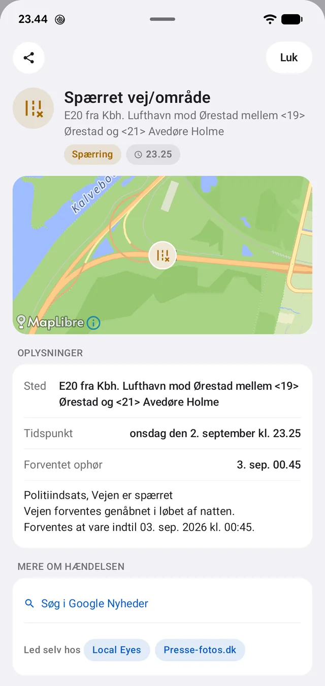
Open an event and it stands as the source wrote it: what happened, where, when, and what is expected next. A road closure carries both the reason — 'police operation, the road is closed' — and when the road is expected to reopen.

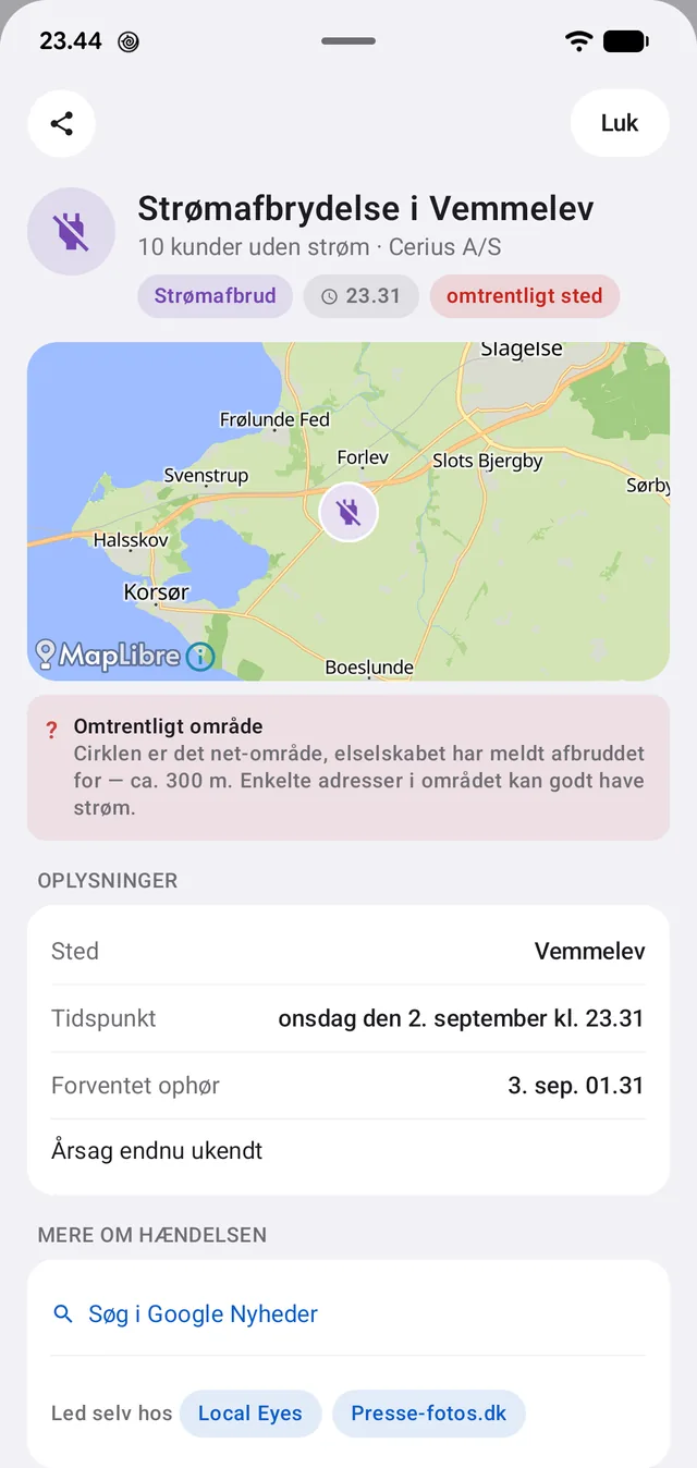
A power cut says how many customers are without power and which utility reported it. And then it does something the feed does not: it says the location is approximate. The circle on the map is the network area the utility reported down, not an address — so it is drawn as a circle and explained in words, rather than shown as a pin that lies about its precision.

At the bottom the source stands with name and link, every single time. That is not decoration: ODIN's 112 pulse may only be reproduced with clear attribution, and the condition has to be met on every event — not once in a colophon.

'Approximate area': the circle is the utility's network area of about 300 m, not an address.
A closed motorway with cause and expected reopening.
04

The area is not drawn — it is calculated

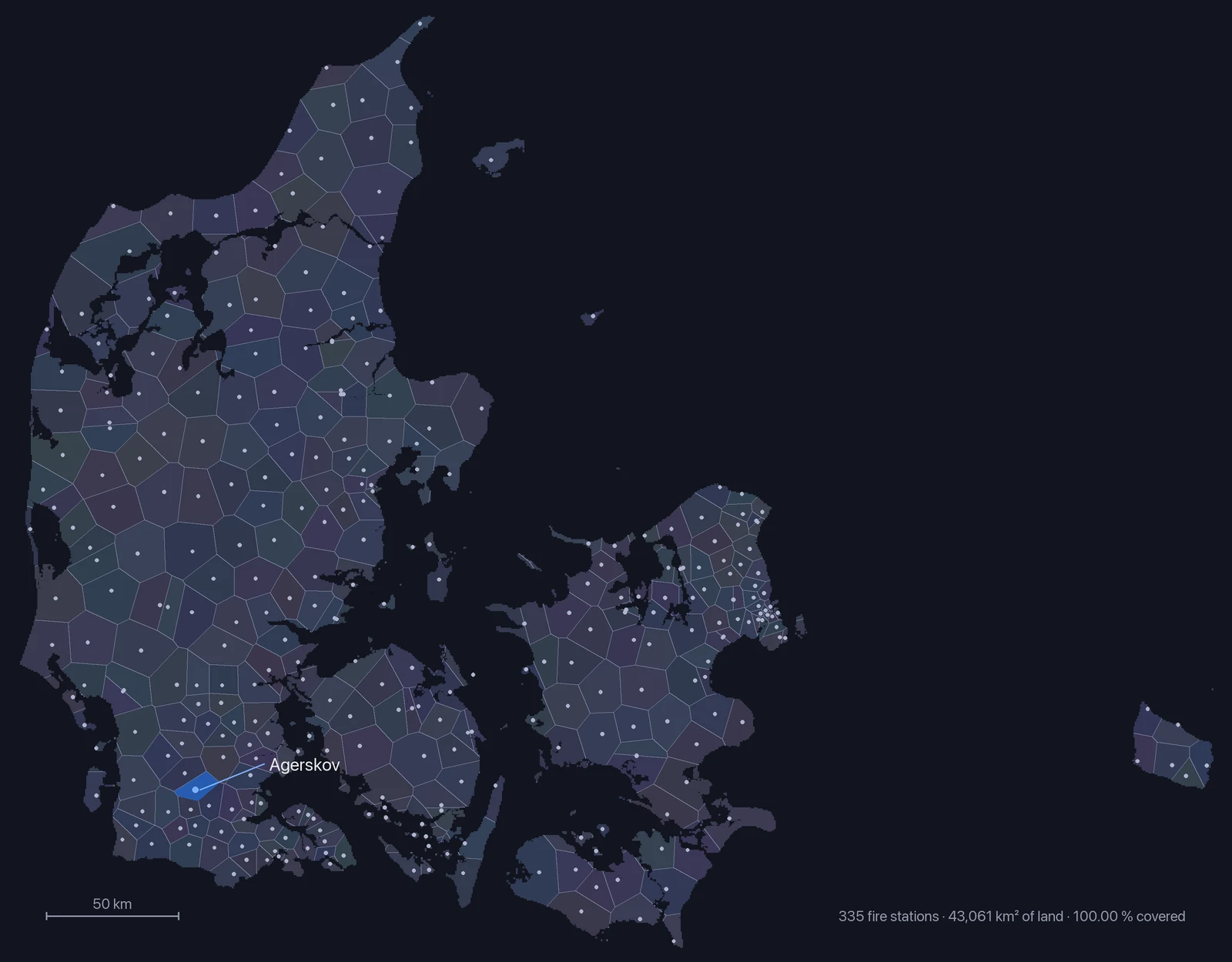
ODIN says which fire station turned out, not where the fire is. The pin on the map is therefore the station, and the app says so outright: the incident happened somewhere inside the dashed field around it. That field is not an estimate placed by hand. It is the station's Voronoi cell clipped to Denmark's land area — the part of the country where that particular station is the nearest of all 335.

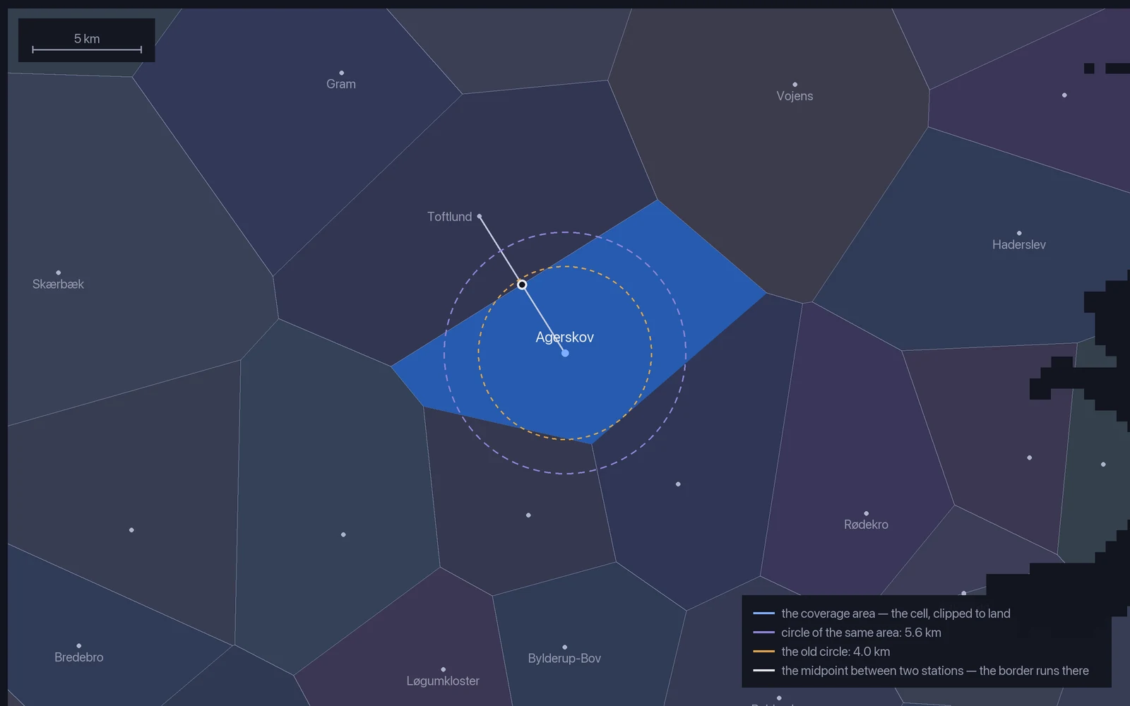
The shape follows from that on its own. The border between two stations is the line halfway between them, and a halfway line is straight — hence a polygon and not a circle. The shape comes out lopsided when the neighbours are: Agerskov has Toftlund close by to the north-west and further to go to the north-east, so the cell stretches that way.

The calculation is one grid and one distance. Denmark's land area sits as 172,244 points 500 metres apart — 43,061 km². Each point is assigned to the nearest of the 335 stations, and the points belonging to one station are finally wrapped in a polygon that is guaranteed to contain them all. The station addresses come from Danske Beredskaber (rbis.dk) and the coordinates from the Danish Agency for Data Supply and Infrastructure.

The area used to be round, and that was wrong. The radius was then half the distance to the nearest neighbouring station — the largest circle that does not overlap the neighbour. It leaves holes by construction: put three stations in a triangle and there is a gap in the middle no circle reaches. Measured on the same grid, the circles the app used to draw covered 41.4 % of Denmark. The sentence 'the incident happened somewhere in here' was therefore wrong for more than half the country. The cells cover 100.00 % — and the table grew from 175 to 335 stations at the same time.

More coverage usually costs precision; here the opposite happens. The drawn area is a median 2.4 times smaller than the smallest circle around the station that would contain it. More truthful and more precise at once.

One thing is worth knowing. The polygon is convex, so a fjord or a bay does not cut a notch — the area comes out slightly too large rather than slightly too small. That is the right way to be wrong when the text promises the incident happened inside it. And the 'about 5.6 km' in the explanation is not a radius the cell has: it is the radius of a circle with the same area, used only to say the size in words.

It is all still an estimate. The fire services' real response areas are not public, and another station may have been the one to turn out. The app says that too — every single time.

  • 335 fire stations, each with its own area
  • 100.00 % of the country covered — measured, not assumed
  • A median of 113 km² of land per station
  • The border between two stations runs exactly halfway
Denmark divided by nearest fire station. Each face is one coverage area; the coast is the 500 m land grid, not a drawn coastline. Agerskov is marked.
Agerskov's cell up close. Every edge lies halfway between two stations — the white ring is the midpoint towards Toftlund. The two dashed circles are there for comparison only.
05

The air ambulance, followed live

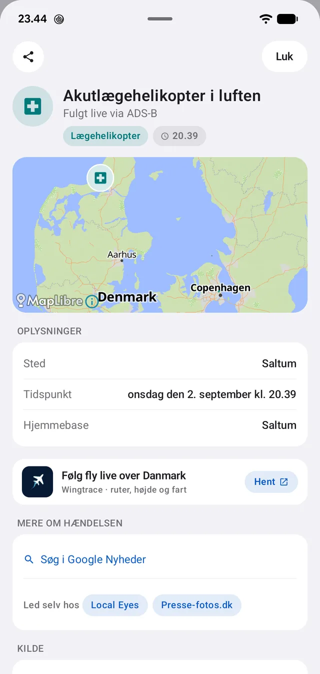
Denmark's five air ambulances broadcast their position over the radio like any other aircraft. BlåBlink listens in through a free ADS-B network and shows them on the map when they are airborne.

The helicopters' tail numbers have been looked up and verified one by one, so it is the right machines being followed and not passing air traffic. If one is airborne it enters the list as an event alongside the others, with its home base noted.

The detail carries the attribution — adsb.lol — and beneath it the sentence the whole app stands on: BlåBlink is an unofficial app with no connection to the police, the emergency services or the road authority. Call 1-1-2 if life is in danger.

'Followed live via ADS-B', with home base and position.
The source stands on every single event — and the caveat with it.
06

Emergency numbers, also without a network

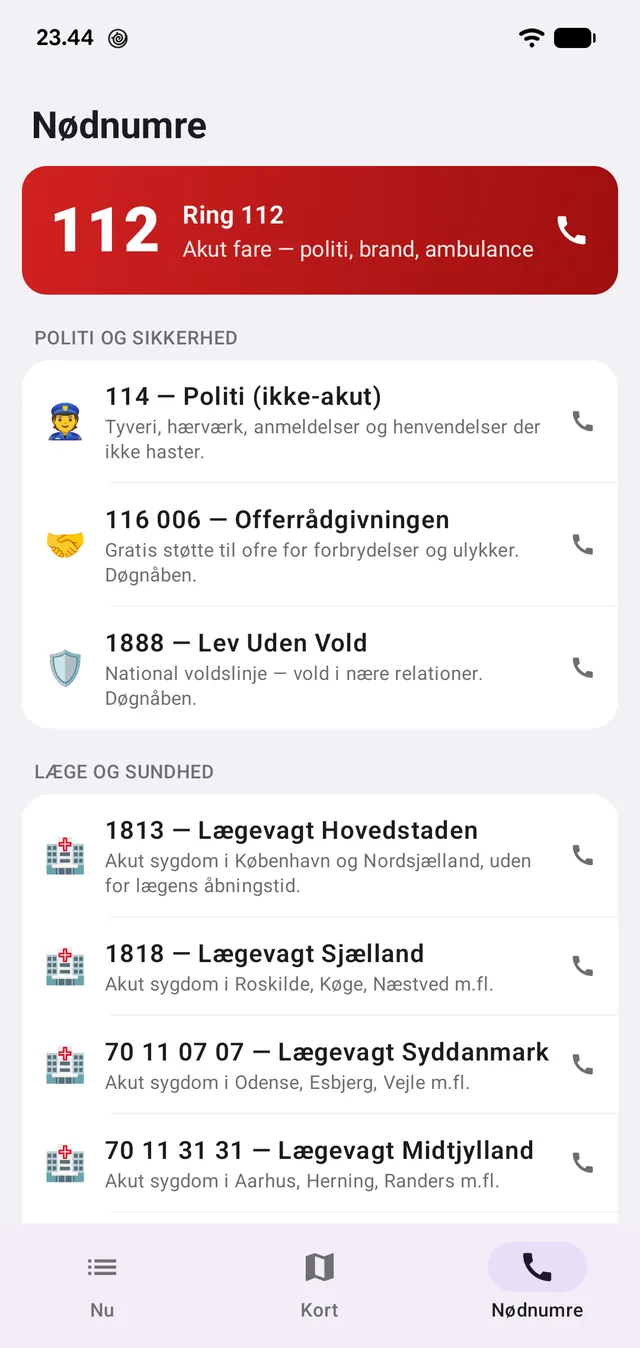
A tab with the numbers you need when something is wrong: 112 at the top in red, and below it 114 for the police when it is not urgent, victim support, the domestic violence line, the four regional out-of-hours doctors, the poison line and the gas and electricity utilities.

The list lives in the app and needs no connection. That is deliberate: it has to work in a basement, in a tunnel and on a phone with no data.

112 at the top, and below it the numbers you would otherwise have to search for. Works offline.
07

You decide what disturbs you

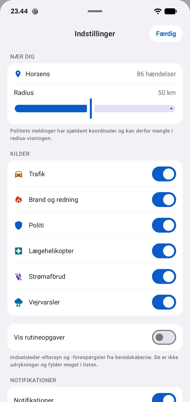
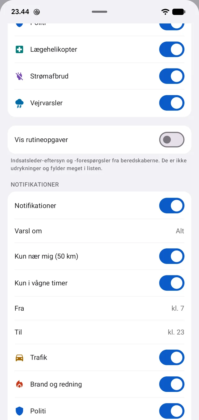
Radius and position are set in one place, and the app says how many events fall inside it. Every source can be switched off on its own — if you only want fire and rescue, you turn the other five off.

The fire services' routine tasks — incident commander inspections and enquiries — are hidden by default. They are not call-outs, and in a sample they filled every fifth slot in the feed.

Notifications can be enabled per source. The app has no server to push messages out; it fetches in the background itself, which is why the app also says that a message may arrive late. Better to say so than to promise otherwise.

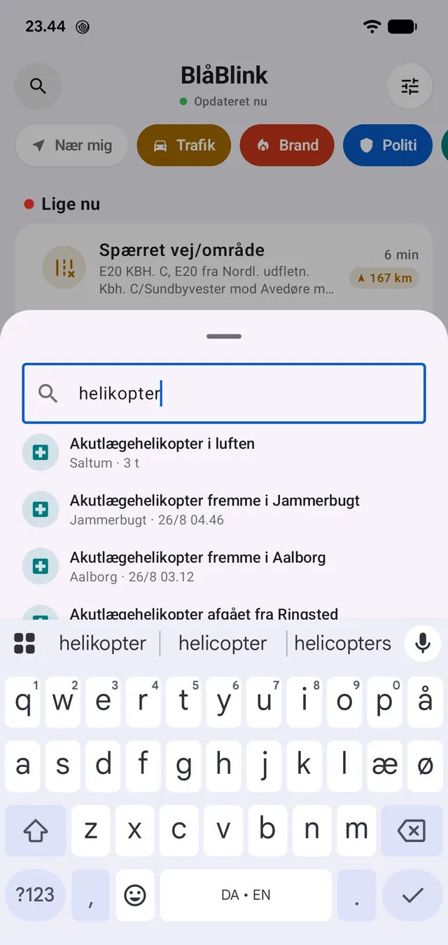
The archive holds around three months of events and can be searched — including when you cannot remember the spelling.

Radius, sources and routine tasks. The number beside the town is events within the radius.
Searching the archive: every helicopter call-out going back in time.

Where the reports come from

Six public sources, each reproduced with name and link on every single event. The app has no reports of its own and no editorial desk.

ODIN 112 pulse (Danish Emergency Management Agency)
Fire and rescue call-outs from the country's fire services
POLITI UPDATE via Ritzau
The police's own reports from 14 districts, the national police and NSK
The Danish Road Directorate
Closures, accidents and icy conditions on state and motorway roads
Green Power Denmark
Unplanned power cuts from 88 utilities
DMI and MeteoAlarm
Official weather warnings
adsb.lol
The air ambulances' position, followed live via ADS-B